Author: Jan Lehmann

Projects

Acquisition of Inselberg vegetation in Brazil

Our master student Milan is currently using our Mavic Pro in Brazil. The aim of his thesis is to determine the water holding capacity of Inselberg vegetation. Therefore, he is flying along several steep sidewalls. More information will follow soon…

Sidewall vegetation of an Inselberg in Brazil. We will calculate the vegetation cover to determine the water holding capacity of an Inselberg.

Projects

Mapping of invasive grasses in Brazil

As part of a master’s thesis, we used our DJI Mavic 2 to map invasive grass patches in the Serra do Cipo National Park. During the flights windy and strong thermal conditions occurred. Nevertheless, we were able to successfully fly over five areas with different levels of invasion. The data will be used as ground truthing to scale up to the entire national park with the help of satellite data.


The studied invasive grass species (yellow)


Going to collect drone image data by bicycle


Image data collection using our Mavic 2 drone.


Beautiful working conditions in the Serra do Cipo Nationalpark


Projects

UAS based glacier mapping and monitoring in Alps

As of last week, we have began research dealing with glacier mapping and monitoring focuesed on a rock glacier in Kaunertal, Ötztal Alps, Austria. The work will be apart of the Master’s thesis of Jordan Bates, an Erasmus Mundus MSc. in Geopsatial Technologies student. Currently the rock glacier is being mapped with Unmanned Aircraft Systems (UAS) and Terrestrial Laser Scanners (TLS) inorder to combine the two data collection means to supplement their individual strengths. The TLS data will provide a more precise measurement with LiDAR along with a view from underneath the face of the glacier and the UAS data will provide a better overall picture from the air with photogrammetry techniques from optically collected data. It is planned that joining these two datasets will create a more complete and accurate depiction of the glacier than more traditional methodologies. This data will then be compared to previous data collections to measure and track its movement.

Aerial view of the rock glacier in Kauntertal, Austria that is being observed in this study


Because of its size, easy set up, and sensor quality, the Mavic 2 Pro is the the sUAS of choice for this work that includes hikes to the top of an alp.


Initial processing of the 3D model and in view is the face/front of the rock glacier

Projects

WingtraOne for biotope type mapping

In cooperation with the LANUV, our student and drone pilot Jan-Patrick Bollow deployed our WingtraOne to collect multispectral image data in a large bog ecosystem. The aim of the project is to generate objectively comprehensible geometric demarcations in order to distinguish the occurring biotope types. The resulting orthomosaic is covering more than 200ha with a GSD of around 7 cm.


WingtraOne after vertical Take-Off


Ready-to-go…


Office of a drone pilot


Image section of the resulting multispectral orthomosaic (green, blue and nir channel with standard deviation)

General

Successful flights with WingtraOne

For the detection of invasive grasses on an island in the German Wadden Sea, we have been able to successfully use our new WingtraOne drone. The flight performance, as well as the resulting image data are very convincing. We are looking forward to new exciting projects with our new member in our drone fleet.


Resulting multispectral imagery (captured with the new Micasense RedEdge MX)

Teaching

UAS Course Field Day

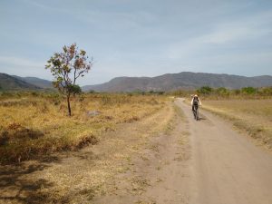
On the first week of June, students in our UAS course from the international Master of Science in Geospatial Technologies program went out to the field to collect data on a small river stemming from the Lake Aasee to begin the analysis on its renaturation process. The teams that took part in the field collection were Sensor and Platform, SenseBox, Image Analysis, and Project Management.

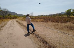
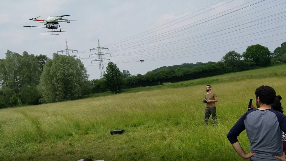
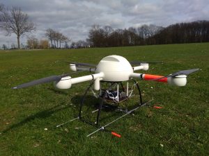
The Sensor and Platform team designed and 3D printed a mount for the Micro Drone md4-1000 gimbal that made it possible to hold both the Sony RGB and Mapir CNIR cameras. They planned a mission at 60m and simultaneous collected two types of data that would have typically taken an additional flight. While half the team prepped the drone and manned the ground control station (GCS) for the flight, the other team members placed ground control points (GCP) across the study area and collected ground truthing samples with the help of the Image Analysis team and GNSS/GPS survey equipment.

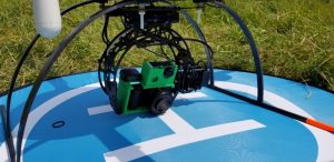
3D printed mount for both cameras

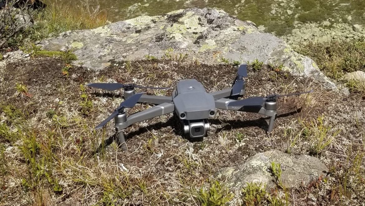
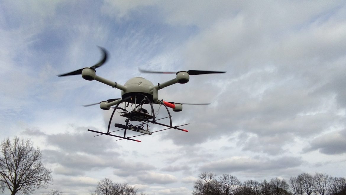
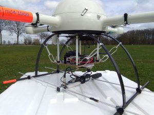
The SenseBox team utilized SenseBox devices to develop two sensors, one to collect humidity and temperature and another for collecting PM2.5 particle data. They attached the sensors to a platform below the drone with their own special modification. The propeller wash from the drone had potential to disturb the accuracy of the sensor readings so the team attached a combination of carbon fiber and plastic tubing to the sensors to expand their reach beyond the propellers.

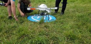
Microdrones md4-1000 with SenseBox and modifications mounted below

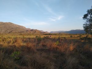
They flew the drone on a horizontal flight path at 60 meters across the study area and would stop at predetermined locations for 10 seconds to collect the SenseBox data. These same locations were replicated and collected on the ground so that an analysis could be made on how the data differs at various elevations throughout the study area.

md4-1000 taken off for the SenseBox mission

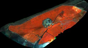
The teams in the field handed off the data to the Image Analysis team where orthomosaics, digital elevation models (DEM), point clouds, NDVI, classification, and interpolations maps will be made and compared to last years data to analyze the renaturation process. The Automated Workflow team is working on ways to automate the processes used from this project and the Web Portal and ESRI Cloud teams are working with unique ways to access and visualize the results. All teams will be presenting their work and results to the public on the 9th of July.

Teaching

The new semester has started

The new summer semester has started and therefore our drones are used in different projects and field courses. In this year’s UAS course in the international Master’s program (Master of Science, M.Sc.) in Geospatial Technologies, different sensors will be used to monitor the renaturation of a small river stream near by Münster. The students will work in the following groups:


1. Image Analysis

2. OpenDroneMap and QGIS workflow

3. SenseBox

4. Sensors and platforms

5. Web portal

6. ESRI cloud services

7. Project management


We are looking forward to an exciting project.


Teaching

First test flights with new payload: Wildlife radio tracking system

Our team member and student Pia Pickenbrock is currently writing her thesis on radio animal tracking using our MD4-1000. She reports:

Last week we conducted first flights with a new equipment for the survey of wild animals. In the long term the goal will be a system that can assist in locating individuals equipped with telemetry transmitters. The material was prepared and assembled in the context of a bachelor project in the the institute of landscape ecology. In this project it is planned to use the drone as an intermediate station for telemetry signals of animal tramsmitters. The signals are received with a RTL-SDR-dongle and are forwarded to a ground station, where they are reconverted to audio signals. There a surveying person might use them to locate an animal via auditorially sensed signal strengths.

The test flights with the quadcopter MD4-1000 showed that the, in some parts quite bulky equipment, had no considerable impact on either drone system or flight characteristics. It consisted of a Raspberry Pi computer and several other small hardware parts mounted on a platform under the quadcopter and a H-antenna attached to the landing skids.


General

The new interdisciplinary nature of the project group

For more than 10 years we have been using unmanned aerial systems (UAS) in our teaching and research activities in the field of Geosciences. Initially started as the “ifgicopter” project group at the Institute of Geoinformatics, the focus has intensified on ecological applications in recent years. In order to emphasize this interdisciplinary nature of the project group (Geoinformatics & Landscape Ecology), the group has renamed itself in “GEO1copter”.

GEO1 is the name of the building in which we work, teach and research together.

Our new logo: